ArcGIS, QGIS or web apps can simply use this map with web map services. WMTS, TileJSON or XYZ tiles are provided for quick access to processed maps.
Sign in to get links.
Sign in to download GeoTIFF.
Overlay & compare
iiif viewer, iiif info json
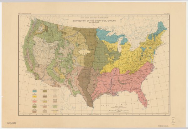
Distribution of the great soil groups (soil provinces)
21198_zz002cfmmg
United States
Relief shown by spot heights. Appears in Washington: U.S. Dept. of Agriculture. Atlas of American agriculture, 1936. Soils, plate 2.
1931
Marbut, Curtis Fletcher, 1863-1935.
Washington, D.C. : Bureau of Chemistry and Soils
31 × 61 cm
1 : 8000000