ArcGIS, QGIS or web apps can simply use this map with web map services. WMTS, TileJSON or XYZ tiles are provided for quick access to processed maps.
Sign in to get links.
Sign in to download GeoTIFF.
Overlay & compare
iiif viewer, iiif info json
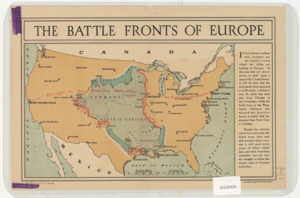
The battle fronts of Europe
21198_zz002cf22g
United States
Map of battle fronts drawn to scale upon a map of the United States showing relative distances of fronts.
1916
Roberts & Leete.
London : Stanford's Geographical Establishment
19 × 26 cm
1 : 2500000