ArcGIS, QGIS or web apps can simply use this map with web map services. WMTS, TileJSON or XYZ tiles are provided for quick access to processed maps.
Sign in to get links.
Sign in to download GeoTIFF.
Overlay & compare
iiif viewer, iiif info json
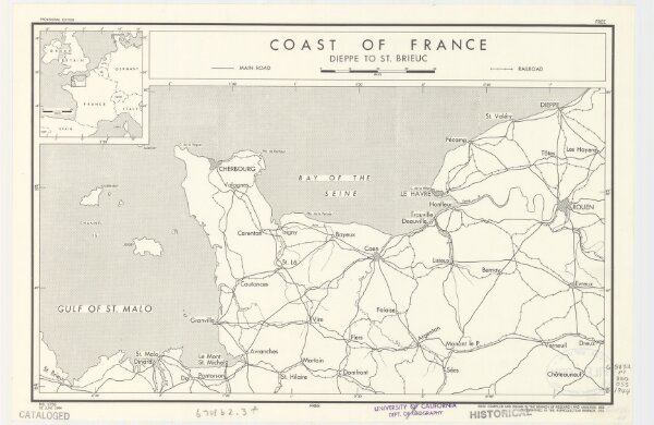
Coast of France : Dieppe to St. Brieuc
21198_zz002cfj8b
California
Provisional ed. Inset: [Location map]. Shows main roads and railroads. Dated: 12 June 1944.
1944
United States. Office of Strategic Services. Research and Analysis Branch
[Washington, D.C.] : R & A, OSS
25 × 38 cm
1 : 885000