ArcGIS, QGIS or web apps can simply use this map with web map services. WMTS, TileJSON or XYZ tiles are provided for quick access to processed maps.
Sign in to get links.
Sign in to download GeoTIFF.
Overlay & compare
iiif viewer, iiif info json
Website
Catalog
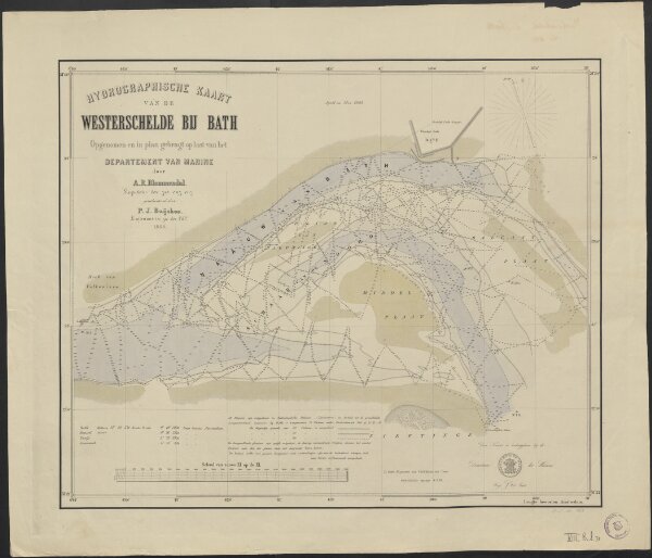
Hydrographische kaart van de Westerschelde bij Bath
1874-351914
Maps of the Netherlands and Dutch regions
1862
opgenomen en in plan gebragt op last van het Departement van Marine door A.R. Blommendal ... geadsisteerd door P.J. Buijskes ...
['s Gravenhage] : Directiën der Marine
60 × 49 cm
1 : 10000
300