ArcGIS, QGIS or web apps can simply use this map with web map services. WMTS, TileJSON or XYZ tiles are provided for quick access to processed maps.
Sign in to get links.
Sign in to download GeoTIFF.
Overlay & compare
iiif viewer, iiif info json
Website
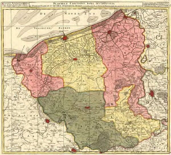
Flandriae Comitatus pars occidentalis
2619267977
MZK
Mollova mapová sbírka
From 1715 to 1730
Visscher, Nicolaes
Schenk, Peter II
48 × 55 cm