ArcGIS, QGIS or web apps can simply use this map with web map services. WMTS, TileJSON or XYZ tiles are provided for quick access to processed maps.
Sign in to get links.
Sign in to download GeoTIFF.
Overlay & compare
iiif viewer, iiif info json
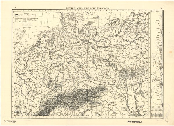
Deutschland, physische Übersicht.
21198_zz002cz116
Europe
Relief shown by hachures. Includes profile. "30."
1898
West Germany? : publisher not identified
30 × 42 cm
1 : 4000000