ArcGIS, QGIS or web apps can simply use this map with web map services. WMTS, TileJSON or XYZ tiles are provided for quick access to processed maps.
Sign in to get links.
Sign in to download GeoTIFF.
Overlay & compare
iiif viewer, iiif info json
Website
11183372493
flickr2
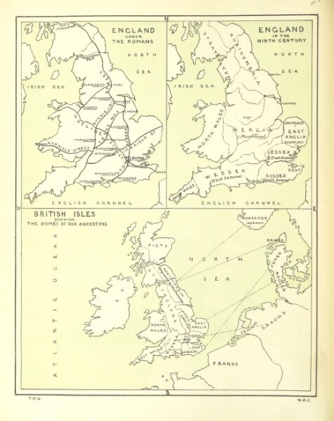
Book: Geography of the British Isles from ten different standpoints, with twenty-one maps
1886
DAVIDSON, Thomas McLaren.
Thomas Laurie
208.6 × 262.9 cm