ArcGIS, QGIS or web apps can simply use this map with web map services. WMTS, TileJSON or XYZ tiles are provided for quick access to processed maps.
Sign in to get links.
Sign in to download GeoTIFF.
Overlay & compare
iiif viewer, iiif info json
Website
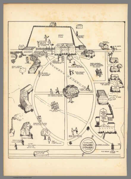
Flying over Howard College
11352.000
missinglocation
Flying over Howard College A.D. 1943. By Bobbie Nichols.
1943
Nichols, Bobbie
Bobbie Nichols
18 × 22 cm