ArcGIS, QGIS or web apps can simply use this map with web map services. WMTS, TileJSON or XYZ tiles are provided for quick access to processed maps.
Sign in to get links.
Sign in to download GeoTIFF.
Overlay & compare
iiif viewer, iiif info json
Website
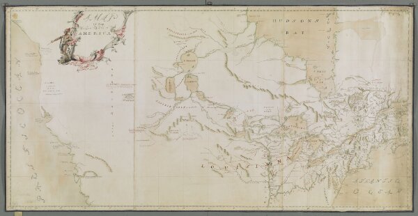
A MAP of the Northern Parts of America.
mapsukutopu119u7u2
ktop
[about 1755].
[John Green for Thomas Jefferys?]