ArcGIS, QGIS or web apps can simply use this map with web map services. WMTS, TileJSON or XYZ tiles are provided for quick access to processed maps.
Sign in to get links.
Sign in to download GeoTIFF.
Overlay & compare
iiif viewer, iiif info json
Website
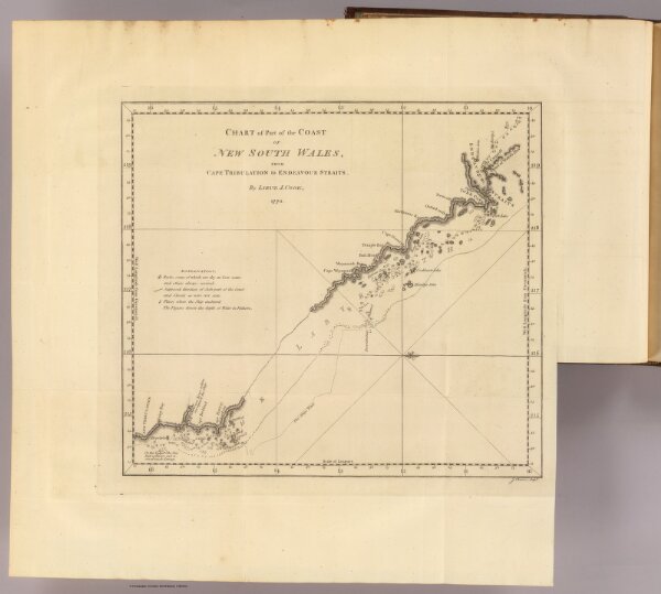
Cape Tribulation-Endeavour Straits.
3403.050
pilot4
Chart of part of the coast of New South Wales, from Cape Tribulation to Endeavour Straits, by Lieut. J. Cook, 1770. J. Cheevers sculpt. (London: printed for W. Strahan; and T. Cadell in the Strand, MDCCLXXIII).
1773
Hawkesworth, John, 1715?-1773
W. Strahan and T. Cadell
34 × 31 cm
1 : 2200000