ArcGIS, QGIS or web apps can simply use this map with web map services. WMTS, TileJSON or XYZ tiles are provided for quick access to processed maps.
Sign in to get links.
Sign in to download GeoTIFF.
Overlay & compare
iiif viewer, iiif info json
Website
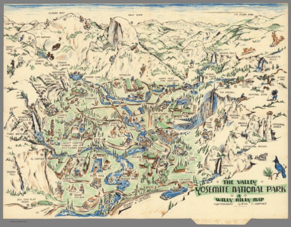
High Sierra country surrounds Yosemite Valley
9987.002
missinglocation
High Sierra country surrounds Yosemite Valley. (on verso) The Valley of Yosemite National Park : a willy nilly map. Cartograph C. Barnes 1946.
1946
Barnes, C.
Crown Print. and Lithographing Co.
37 × 24 cm