ArcGIS, QGIS or web apps can simply use this map with web map services. WMTS, TileJSON or XYZ tiles are provided for quick access to processed maps.
Sign in to get links.
Sign in to download GeoTIFF.
Overlay & compare
iiif viewer, iiif info json
Website
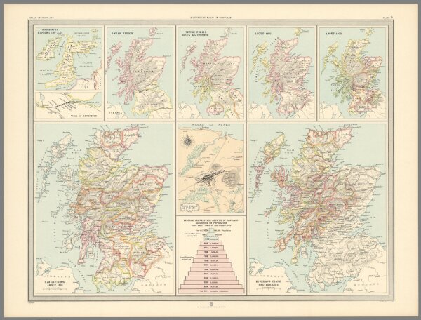
Plate 9. Historical Maps of Scotland.
12428.034
pilot5
Plate 9. Historical Maps of Scotland. According to Ptolemy 150 A.D. Wall of Antonius. Roman Period. Pictish Period, 6th to 9th Century. About 1100. About 1300. Old Divisions about 1600. Edinburgh about 1745. Highland Clans and Families.
1912
Bartholomew, J.G.
Edinburgh Geographical Institute
62 × 47 cm