ArcGIS, QGIS or web apps can simply use this map with web map services. WMTS, TileJSON or XYZ tiles are provided for quick access to processed maps.
Sign in to get links.
Sign in to download GeoTIFF.
Overlay & compare
iiif viewer, iiif info json
Website
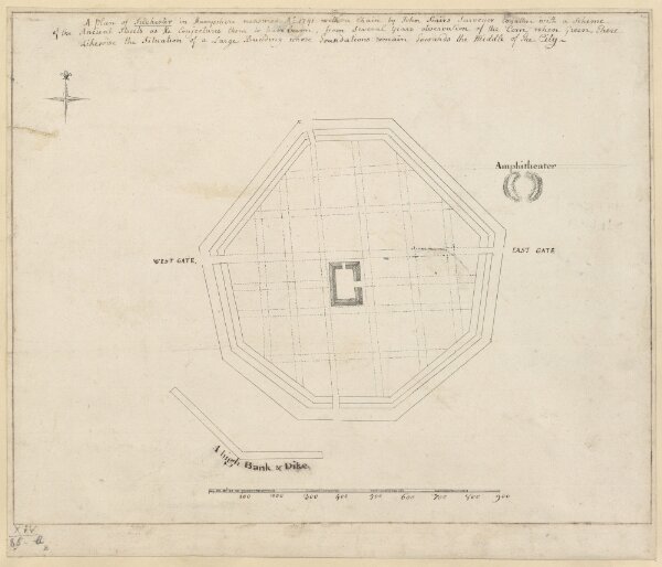
A Plan of Silchester in Hampshire measured A.o 1741 with a Chain
mapsukutopu14u85ub
ktop
[1741 c.]
Stairs, John
[J. Stairs]