ArcGIS, QGIS or web apps can simply use this map with web map services. WMTS, TileJSON or XYZ tiles are provided for quick access to processed maps.
Sign in to get links.
Sign in to download GeoTIFF.
Overlay & compare
Website
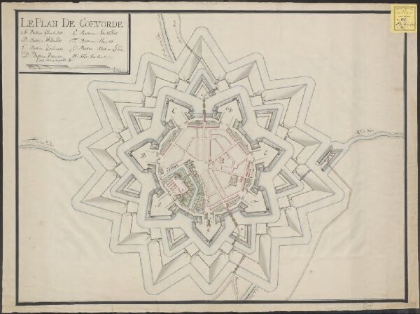
Le plan de Coevorde
1874-290946
Siege maps and fortification plans
1760
[S.l.] : Fecit D.G.B. van Daelhoff
68 × 52 cm
1 : 2215