ArcGIS, QGIS or web apps can simply use this map with web map services. WMTS, TileJSON or XYZ tiles are provided for quick access to processed maps.
Sign in to get links.
Sign in to download GeoTIFF.
Overlay & compare
iiif viewer, iiif info json
Website
11020077383
flickr2
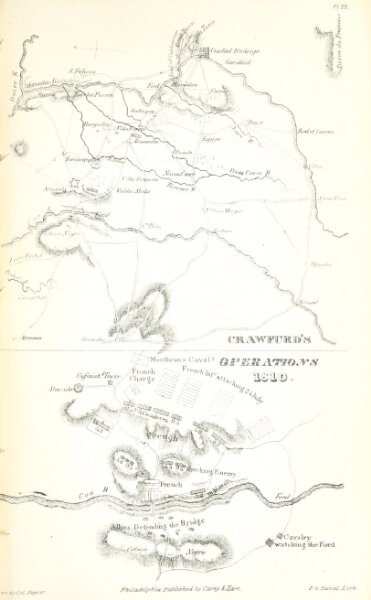
Book: History of the War in the Peninsula and in the South of France, from the Year 1807 to the Year 1814 ... From the fourth edition ... With ... engravings
1842
Napier, William Francis Patrick Sir
Carey & Hart
162.6 × 262.7 cm