ArcGIS, QGIS or web apps can simply use this map with web map services. WMTS, TileJSON or XYZ tiles are provided for quick access to processed maps.
Sign in to get links.
Sign in to download GeoTIFF.
Overlay & compare
iiif viewer, iiif info json
Website
Catalog
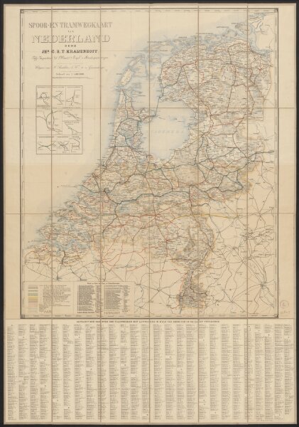
Spoor- en tramwegkaart van Nederland
1874-348500
Maps of the Netherlands and Dutch regions
1899
door Jhr. C. R. T. Kraijenhoff, Adj. Inspecteur b/d Maatij t. Expl. v. Staatsspoorwegen.
's-Gravenhage : Smulders
73 × 88 cm
1 : 400000
300