ArcGIS, QGIS or web apps can simply use this map with web map services. WMTS, TileJSON or XYZ tiles are provided for quick access to processed maps.
Sign in to get links.
Sign in to download GeoTIFF.
Overlay & compare
Website
Original viewer
Catalog
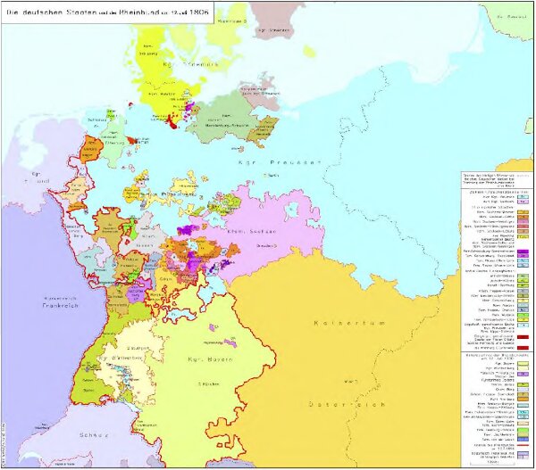
Die deutschen Staaten und der Rheinbund am 12. Juli 1806
hebisppn_400724650
GeoPortOst II
Deutschland Rheinbund
1806
2006
Kunz, Andreas ; Moeschl, Joachim Robert