ArcGIS, QGIS or web apps can simply use this map with web map services. WMTS, TileJSON or XYZ tiles are provided for quick access to processed maps.
Sign in to get links.
Sign in to download GeoTIFF.
Overlay & compare
iiif viewer, iiif info json
Website
Catalog
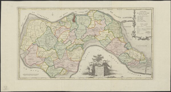
Kaart van het eiland Zuidbeveland
1874-351075
Maps of the Netherlands and Dutch regions
1753
op ordre van ... W.C.H. Friso prinse van Oranje en Nassau etc. etc. etc. meetkundig opgenomen door W.T. Hattinga ... in den jaare 1747 en 1748.
te Amsterdam : by Is. Tirion
63 × 33 cm
1 : 50000
300