ArcGIS, QGIS or web apps can simply use this map with web map services. WMTS, TileJSON or XYZ tiles are provided for quick access to processed maps.
Sign in to get links.
Sign in to download GeoTIFF.
Overlay & compare
iiif viewer, iiif info json
Website
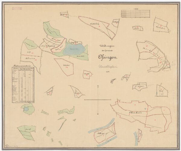
Ossingen: Gemeinde- und Staatswaldungen: Gemeindewaldungen; Übersichtsplan
PLAN_P_647_14
Maps
Mit Verzeichnis der Flächeninhalte der 29 Waldabteilungen.
From 1915-01-01 to 1915-12-31
75.5 × 63 cm
1 : 5000
300