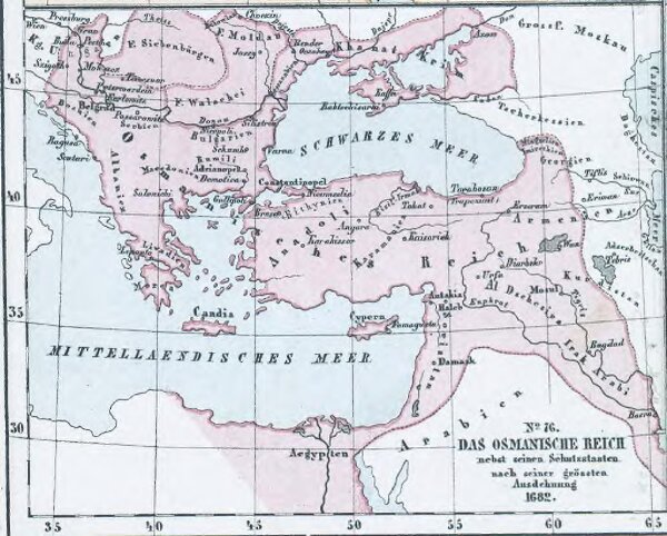
Das Osmanische Reich nebst seinen Schutzstaaten nach seiner grössten Ausdehnung 1682
ArcGIS, QGIS or web apps can simply
use this map with web map services.
WMTS, TileJSON or XYZ tiles
are provided for quick access to processed maps.
Sign in to get links.