ArcGIS, QGIS or web apps can simply use this map with web map services. WMTS, TileJSON or XYZ tiles are provided for quick access to processed maps.
Sign in to get links.
Sign in to download GeoTIFF.
Overlay & compare
iiif viewer, iiif info json
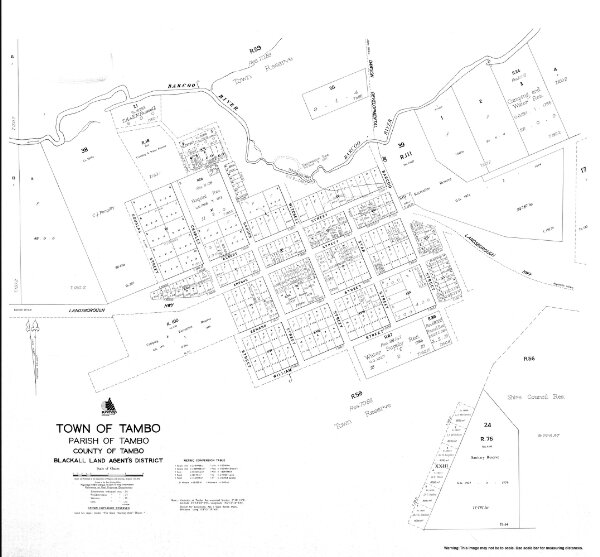
Town of Tambo
cad-map-town-tambo-1976
Town Maps Series 1
Cadastral map of the Town of Tambo displaying real property information; street names and Administrative Areas including Parish; County and Land Agents District
1976
Department of Natural Resources and Mines
87 × 81 cm
250