ArcGIS, QGIS or web apps can simply use this map with web map services. WMTS, TileJSON or XYZ tiles are provided for quick access to processed maps.
Sign in to get links.
Sign in to download GeoTIFF.
Overlay & compare
Website
Original viewer
Catalog
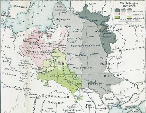
Die Teilungen Polens
gbvppn_679404570_86_1
GeoPortOst II
Polen-Litauen Teilungen Polens
From 1772 to 1795
1896
1 : 10000000