ArcGIS, QGIS or web apps can simply use this map with web map services. WMTS, TileJSON or XYZ tiles are provided for quick access to processed maps.
Sign in to get links.
Sign in to download GeoTIFF.
Overlay & compare
iiif viewer, iiif info json
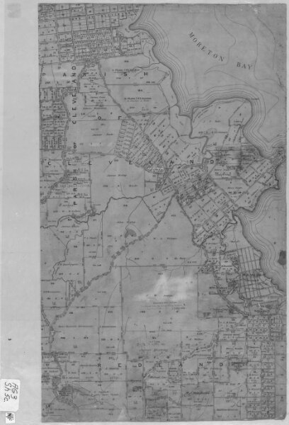
Moreton 20 Chain map AG3 series sheet 5c
cad-map-20chn-moreton-ag3-sh5c-ca1909
20 Chain Moreton AG3 (collection 17)
Cadastral map of Moreton 20 Chain (1:15840) map AG3 series sheet 5c displaying real property information and Administrative Areas including Parishes
1909
Department of Resources
63.432269164000004 × 63.432269164000004 cm
600