ArcGIS, QGIS or web apps can simply use this map with web map services. WMTS, TileJSON or XYZ tiles are provided for quick access to processed maps.
Sign in to get links.
Sign in to download GeoTIFF.
Overlay & compare
Website
Original viewer
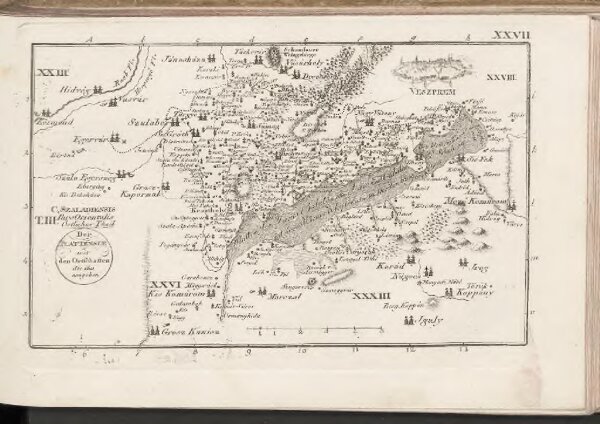
C. Szaladiensis. Tab. III
BV043438810
pilot
Ungarn Komitat Zala
1804
10 × 17 cm