ArcGIS, QGIS or web apps can simply use this map with web map services. WMTS, TileJSON or XYZ tiles are provided for quick access to processed maps.
Sign in to get links.
Sign in to download GeoTIFF.
Overlay & compare
iiif viewer, iiif info json
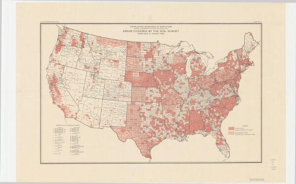
Areas covered by the soil survey, completed to January 1934
21198_zz002cfmph
United States
Includes numbered list of reconnaissance surveys. "Atlas of American Agriculture, Soils, Plate 1."
1934
United States. Bureau of Chemistry and Soils.
[Washington, D.C.?] : The Bureau
38 × 60 cm
1 : 7900000