ArcGIS, QGIS or web apps can simply use this map with web map services. WMTS, TileJSON or XYZ tiles are provided for quick access to processed maps.
Sign in to get links.
Sign in to download GeoTIFF.
Overlay & compare
iiif viewer, iiif info json
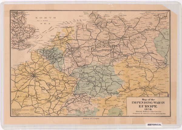
Map of the impending war in Europe 1870 : showing railway connections &c.
21198_zz002cf1ns
Europe
Shows railroads completed, under construction, and projected, highways, steamship lines, boundaries of the German Zollverein, and state boundaries.
1870
Seifert & Lawton, publisher.
Milwaukee, Wis. : Seifert & Lawton
32 × 48 cm