ArcGIS, QGIS or web apps can simply use this map with web map services. WMTS, TileJSON or XYZ tiles are provided for quick access to processed maps.
Sign in to get links.
Sign in to download GeoTIFF.
Overlay & compare
iiif viewer, iiif info json
Website
11154302484
flickr2
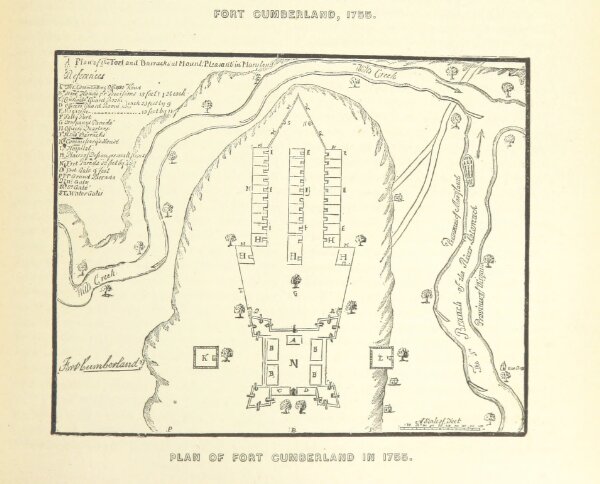
Book: History of Western Maryland. ... Including biographical sketches. ... Illustrated
1882
SCHARF, John Thomas.
L. H. Everts
191 × 154.3 cm