ArcGIS, QGIS or web apps can simply use this map with web map services. WMTS, TileJSON or XYZ tiles are provided for quick access to processed maps.
Sign in to get links.
Sign in to download GeoTIFF.
Overlay & compare
iiif viewer, iiif info json
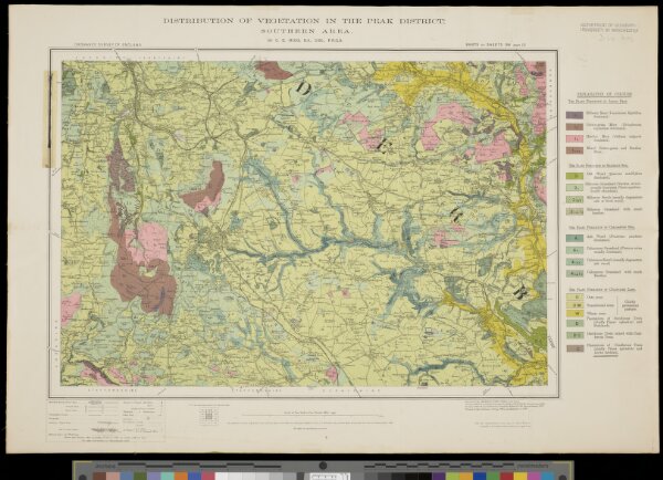
Distribution of vegetation on the Peak District: Southern area
JRL221202804
Teaching and Research Collection
Ordnance Survey
Ordnance Survey Office
46 × 31 cm
1 : 63360