ArcGIS, QGIS or web apps can simply use this map with web map services. WMTS, TileJSON or XYZ tiles are provided for quick access to processed maps.
Sign in to get links.
Sign in to download GeoTIFF.
Overlay & compare
iiif viewer, iiif info json
Website
11045147575
flickr2
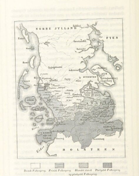
Book: Den danske Stat, en almindelig geographisk Skildring for Folket. Med mange Illustrationer
1855
ERSLEV, Edvard.
153 × 194.2 cm