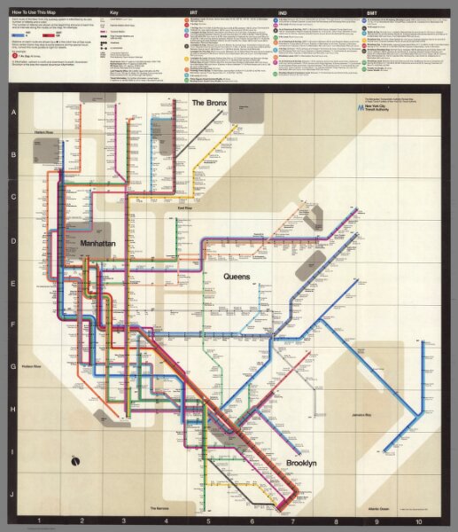
The Metropolitan Transportation Authority revised map of the rapid transit facilities of New York City Transit Authority
ArcGIS, QGIS or web apps can simply
use this map with web map services.
WMTS, TileJSON or XYZ tiles
are provided for quick access to processed maps.
Sign in to get links.