ArcGIS, QGIS or web apps can simply use this map with web map services. WMTS, TileJSON or XYZ tiles are provided for quick access to processed maps.
Sign in to get links.
Sign in to download GeoTIFF.
Overlay & compare
iiif viewer, iiif info json
Website
Original viewer
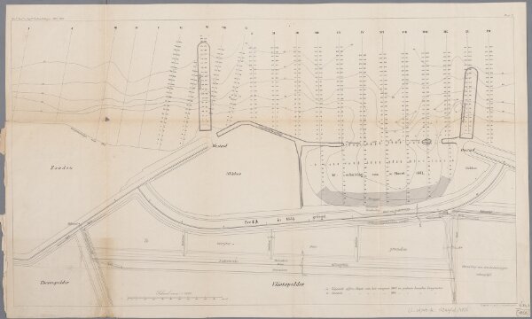
Vlietepolder
0106050657001
1800-1880
Annotatie: Uit: Verhandelingen van het Koninklijk Instituut van Ingenieurs, 1865/1866, pl. 3
1866
[S.l. : s.n.] / (['s-Gravenhage : I. & H. van Langenhuysen])
33 × 58 cm
1 : 2000
300