ArcGIS, QGIS or web apps can simply use this map with web map services. WMTS, TileJSON or XYZ tiles are provided for quick access to processed maps.
Sign in to get links.
Sign in to download GeoTIFF.
Overlay & compare
iiif viewer, iiif info json
Website
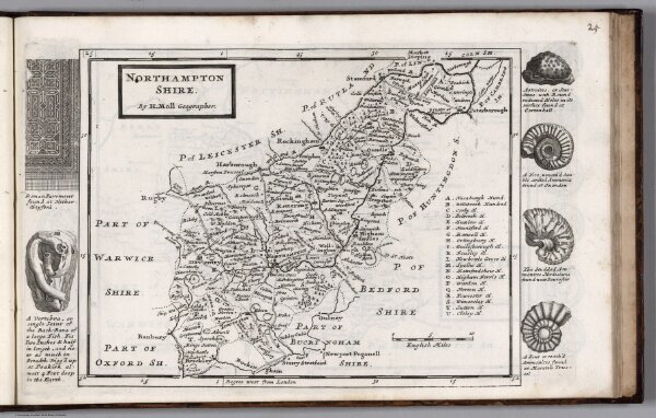
Huntingtonshire. By H. Moll Geographer
9883.027
missinglocation
Huntingtonshire. By H. Moll Geographer. (to accompany) A set of fifty new and correct maps of the counties of England and Wales, &c. 1724.
1724
Moll, Herman, d. 1732
J. Bowles
32 × 20 cm
1 : 350000