ArcGIS, QGIS or web apps can simply use this map with web map services. WMTS, TileJSON or XYZ tiles are provided for quick access to processed maps.
Sign in to get links.
Sign in to download GeoTIFF.
Overlay & compare
iiif viewer, iiif info json
Website
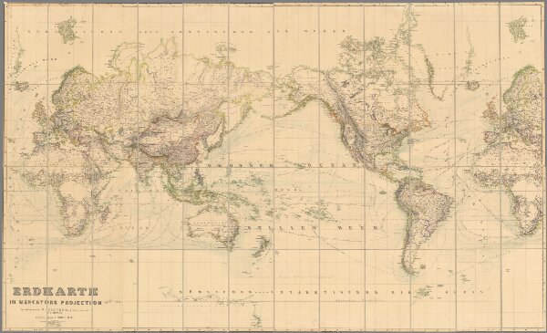
Erdkarte in Mercators Projection
11679.003
missinglocation
Erdkarte in Mercators Projection. Bearbeitet von H. Kiepert, gestochen von C.L. Ohmann ; Berlin, Verlag von D. Reimer, 1856.
1856
Ohmann, Carl Ludwig
Verlag von D. Reimer
161 × 96 cm
1 : 30800000