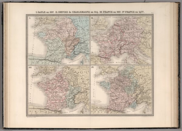
I. Gaule en 507. II. Empire de Charlemagne en 814. III. France en 987. IV. France en 1677.
ArcGIS, QGIS or web apps can simply
use this map with web map services.
WMTS, TileJSON or XYZ tiles
are provided for quick access to processed maps.
Sign in to get links.