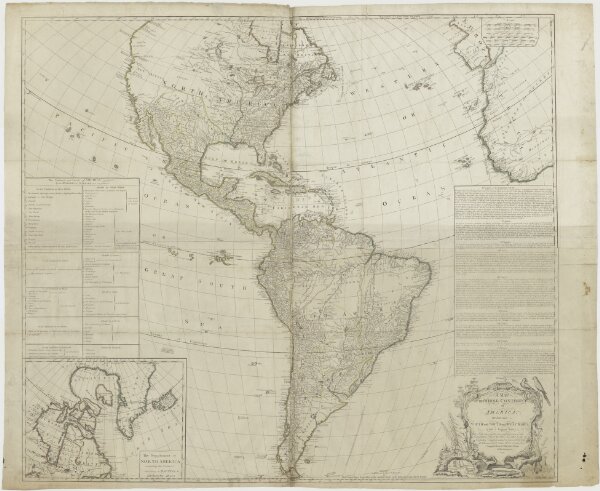
A Map of the whole continent of America, divided into North and South and West Indies etc. Vier bladen.
ArcGIS, QGIS or web apps can simply
use this map with web map services.
WMTS, TileJSON or XYZ tiles
are provided for quick access to processed maps.
Sign in to get links.