ArcGIS, QGIS or web apps can simply use this map with web map services. WMTS, TileJSON or XYZ tiles are provided for quick access to processed maps.
Sign in to get links.
Sign in to download GeoTIFF.
Overlay & compare
iiif viewer, iiif info json
Website
Catalog
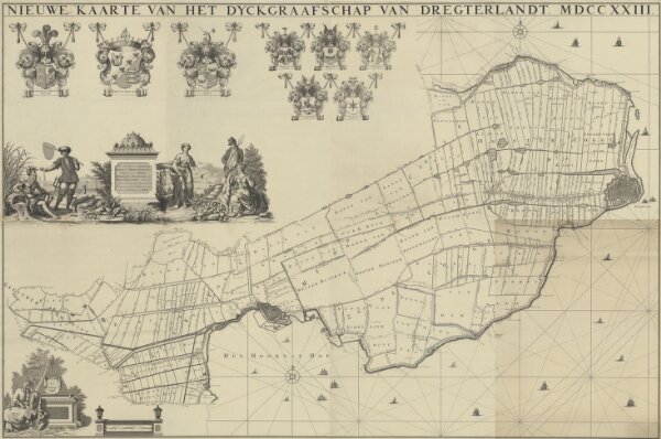
Nieuwe kaarte van het dyckgraafschap van Dregterlandt MDCCXXIII
1874-351621
Maps of the Netherlands and Dutch regions
1723
[Govert Oostwoudt]
Te Amsterdam : bij Hendrik de Leth
198 × 130 cm
1 : 10000
300