ArcGIS, QGIS or web apps can simply use this map with web map services. WMTS, TileJSON or XYZ tiles are provided for quick access to processed maps.
Sign in to get links.
Sign in to download GeoTIFF.
Overlay & compare
iiif viewer, iiif info json
Website
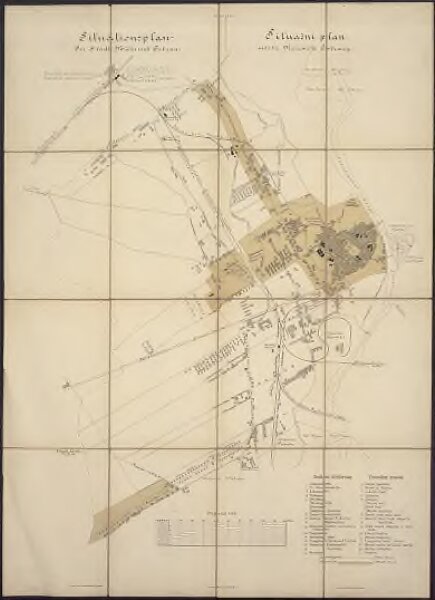
Situationsplan der Stadt Mährisch Ostrau =
9b23b9ff-eab9-45c8-83a9-292c707393cb
MZK_1
Situační plán města Moravské Ostravy
From 1880 to 1900
Hebling, Ernst
Verlag der Stadtgemeinde M. Ostrau
1 : 7200