ArcGIS, QGIS or web apps can simply use this map with web map services. WMTS, TileJSON or XYZ tiles are provided for quick access to processed maps.
Sign in to get links.
Sign in to download GeoTIFF.
Overlay & compare
iiif viewer, iiif info json
Website
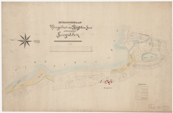
Seegräben: Ufergebiet des Pfäffikersees; Situationsplan
PLAN_L_51
Maps
Beilage zum Beschluss des Regierungsrates vom 11. Februar 1888.
From 1887-11-01 to 1887-11-30
Bachofen, H., Konkordatsgeometer, in Uster
103.2 × 67.5 cm
1 : 2000
300