ArcGIS, QGIS or web apps can simply use this map with web map services. WMTS, TileJSON or XYZ tiles are provided for quick access to processed maps.
Sign in to get links.
Sign in to download GeoTIFF.
Overlay & compare
iiif viewer, iiif info json
Website
Original viewer
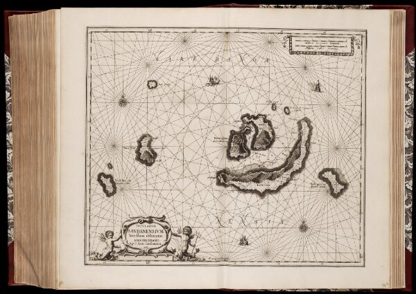
Insvlarvm Bandanensivm novißima delineatio / J. van Loon delin. et sculp
0106051080116
1600-1800
Annotatie: Zeekaart; Origineel is Blad 194 in atlas factice; Annotatie geografische gegevens: Schaalstokken op kaart: 3 Milliaria Germanica Communia (=9,7 cm), en: 4 Milliaria Gallica Communia (=9,7 cm)
1657
Johan van Loon ca.1612-1686; Johannes Janssonius 1588-1664
Amstelodami : apud Ioan. Ianssonium
1 : 237000
300