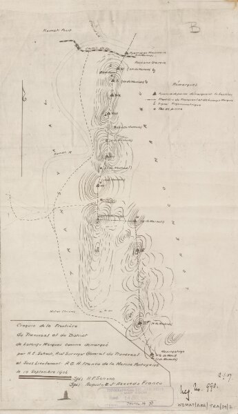
Transvaal-Portuguese Frontr: between Incomati & Matingatinga Rivers. S: of Komati Poort.' - War Office ledger. Created under the auspices of H.E. Schoch and A.J'A. Franco. 'Croquis de la Frontière du Transvaal et du District de Lorenço Marques. Le 10 Septembre 1906.'
ArcGIS, QGIS or web apps can simply
use this map with web map services.
WMTS, TileJSON or XYZ tiles
are provided for quick access to processed maps.
Sign in to get links.