ArcGIS, QGIS or web apps can simply use this map with web map services. WMTS, TileJSON or XYZ tiles are provided for quick access to processed maps.
Sign in to get links.
Sign in to download GeoTIFF.
Overlay & compare
iiif viewer, iiif info json
Website
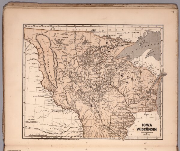
Iowa and Wisconsin
4861.017
pilot2
Iowa and Wisconsin. Chiefly from the map of N.J. Nicollet. Entered ... 1844 by Sidney E. Morse and Samuel Breese ... New York. (New York: Published by Harper & Brothers, 1845). (to accompany) Morse's Cerographic Maps. No. II.
1845
Breese, Samuel
Harper and Brothers
38 × 32 cm
1 : 3380000