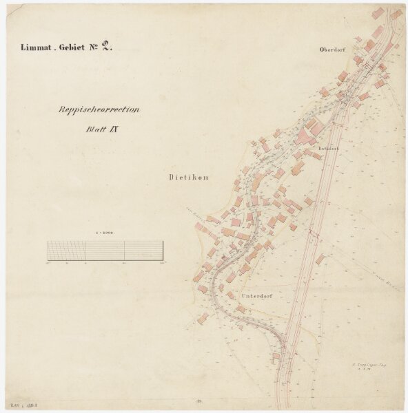
Birmensdorf bis Dietikon: Von oberhalb Landikon bis zur Einmündung in die Limmat, Reppischkorrektion: Blatt IX: Dietikon: Oberdorf bis Unterdorf; Situationsplan (Limmat-Gebiet Nr. 2)
ArcGIS, QGIS or web apps can simply
use this map with web map services.
WMTS, TileJSON or XYZ tiles
are provided for quick access to processed maps.
Sign in to get links.