ArcGIS, QGIS or web apps can simply use this map with web map services. WMTS, TileJSON or XYZ tiles are provided for quick access to processed maps.
Sign in to get links.
Sign in to download GeoTIFF.
Overlay & compare
iiif viewer, iiif info json
Website
Original viewer
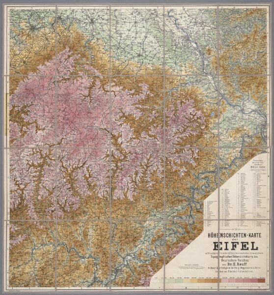
Höhenschichten-Karte der Eifel / von H. Rauff ; gezeichn. von W. Rose
0106050056001
1880-1900
Annotatie geografische gegevens: Gebaseerd op: Topografische Uebersichtskarte des Deutschen Reiches
1900
Hermann Rauff; W. Rose fl. 1900
Bonn : Cohen
67 × 62 cm
1 : 200000
300