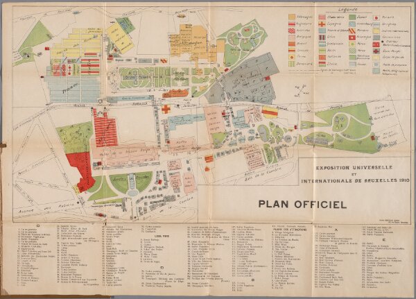
Plan officiel, uit: Exposition universelle et internationale de Bruxelles 1910 : plan officiel
ArcGIS, QGIS or web apps can simply
use this map with web map services.
WMTS, TileJSON or XYZ tiles
are provided for quick access to processed maps.
Sign in to get links.