ArcGIS, QGIS or web apps can simply use this map with web map services. WMTS, TileJSON or XYZ tiles are provided for quick access to processed maps.
Sign in to get links.
Sign in to download GeoTIFF.
Overlay & compare
iiif viewer, iiif info json
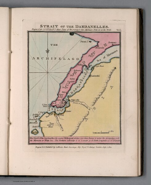
Plate 49 from Vol. 1: Strait of the Dardanelles
13189.051
missinglocation
Strait of the Dardanelles. Engraved for Luffman's Select plans of the principal cities, ports, harbours, forts, &c. in the world. Engraved and published, by Luffman. London. July 1, 1800.
1800
1802
Luffman, John, 1756-1846
John Luffman
12 × 15 cm
1 : 800000