ArcGIS, QGIS or web apps can simply use this map with web map services. WMTS, TileJSON or XYZ tiles are provided for quick access to processed maps.
Sign in to get links.
Sign in to download GeoTIFF.
Overlay & compare
iiif viewer, iiif info json
Website
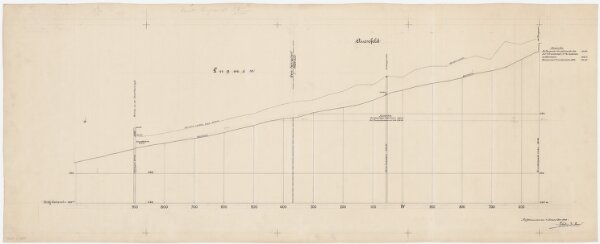
Pfäffikon, Fehraltorf: Luppmen; Längsprofil (Tösszuflüsse linkes Ufer, Nr. 3)
PLAN_L_2859
Others
Kilometer 3.550 bis 4.900.
1908-12-01
Aufnahme: Schmid, Rudolf, Geometer und Wasserbau-Assistent im Tiefbauamt des Kantons Zürich, von Otelfingen, in Zollikon
100 × 40.4 cm
1 : 2000
300