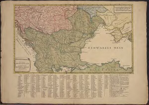
Kriegs-Schauplaz oder Graenz-Carte Oesterreichs, Ruslands und der Türkey. Von dem Jahr 1789
ArcGIS, QGIS or web apps can simply
use this map with web map services.
WMTS, TileJSON or XYZ tiles
are provided for quick access to processed maps.
Sign in to get links.