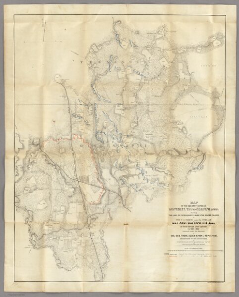
Map Of The Country Between Monterey, Tenn. & Corinth, Miss.
Identifier
3870.001
Collection
pilot3
Description
Map Of The Country Between Monterey, Tenn. & Corinth, Miss. showing The Lines Of Entrenchments Made & The Routes Followed by The U.S. Forces under the Command of Maj. Genl. Halleck, U.S. Army, In Their Advance Upon Corinth, In May 1862: Surveyed under the direction of Col Geo. Thom, A.D.C. & Chief Of Topl Engrs. Department Of The Mississippi, by Lieuts. Fred. Schraag and C.L. Spangenberg Asst. Topl. Engrs. and drawn by Lieut. Otto H. Matz Asst. Topl. Engr. Lith of J. Bien, 180 Broadway N.Y.