ArcGIS, QGIS or web apps can simply use this map with web map services. WMTS, TileJSON or XYZ tiles are provided for quick access to processed maps.
Sign in to get links.
Sign in to download GeoTIFF.
Overlay & compare
iiif viewer, iiif info json
Website
Catalog
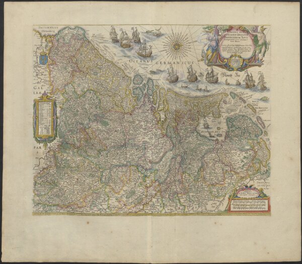
NOVUS XVII | INFERIORIS GERMANIÆ | PROVINCIARUM TYPUS
1874-403826-001
Blaeu atlases
From 1664 to 1665
de integro multis in locis emendatus à Guliel. Ianßonio.
Josua | vanden Ende sculp.
Ghedruckt | t'Amsterdam, | bij Willem Ianszoon op 't Water | inde vergulde Zonnewyser
50 × 40 cm
300