ArcGIS, QGIS or web apps can simply use this map with web map services. WMTS, TileJSON or XYZ tiles are provided for quick access to processed maps.
Sign in to get links.
Sign in to download GeoTIFF.
Overlay & compare
iiif viewer, iiif info json
Website
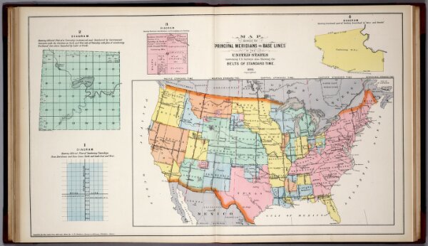
Principal Meridians and Base Lines in the United States. Standard Time.
3307.049
missinglocation
Map Showing the Principal Meridians and Base Lines in the United States Governing U.S. Surveys also Showing the Belts of Standard Time, 1893.
1893
1894
Huebinger, M. & Co.
M. Huebinger & Co.
73 × 43 cm